Bird's-eye view of London seen in 280-year-old map

 London in the 18th Century/Atlantic Publishing
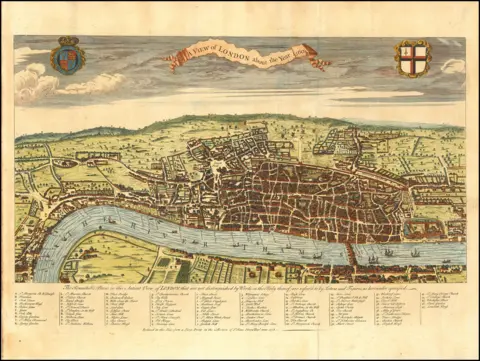
An 18th Century official map of London is to be republished 280 years after its first printing.
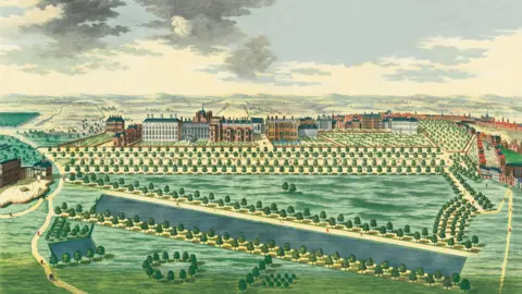
John Rocque's An Exact Survey of the Cities of London and Westminster, and the Borough of Southwark provided an unprecedented, detailed bird's-eye view of the capital for the first time.
The outskirts of London were Hyde Park, Marylebone, Vauxhall and Spitalfields and the city's population was about 650,000 - including 551 people living on London Bridge.
English Heritage historian Steven Brindle described the map as "almost miraculous" considering the simple tools available to Rocque. It has been reproduced in a new book, London in the 18th Century.
 London in the 18th Century/Atlantic Publishing
Brindle explained that mapmaking was much harder in Rocque's era than it is now.
"Rocque would have set out with a couple of assistants and some very basic tools.
"A chain, 66ft long, a surveyor's wheel and a notebook, and they would go over, for example, a field, and they would measure it on all its sides, and they would draw that as accurately as they could.
"It might be a few days' work. And it's really accurate.
"This is what almost seems miraculous when you understand how simple the tools he had to work with were."
 London in the 18th Century/Atlantic Publishing
![London in the 18th Century/Atlantic Publishing detailed map in black and white showing Spittle Fields [sic] and environs](https://ichef.bbci.co.uk/news/480/cpsprodpb/c6c3/live/940c0af0-23c6-11f1-b050-bdbe6e966f25.png.webp) London in the 18th Century/Atlantic Publishing
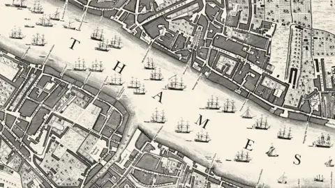
London in the 18th Century/Atlantic Publishing"The City of London was packed with dense alleys and streets, a lot of them very insanitary," Brindle said.
"There were slums just a couple of streets away from really rich merchants living in their houses. The city had large fields, orchards - and tall ships crowded the Thames.
"It's all depicted on Rocque's masterpiece created in 1746."
 London in the 18th Century/Atlantic Publishing
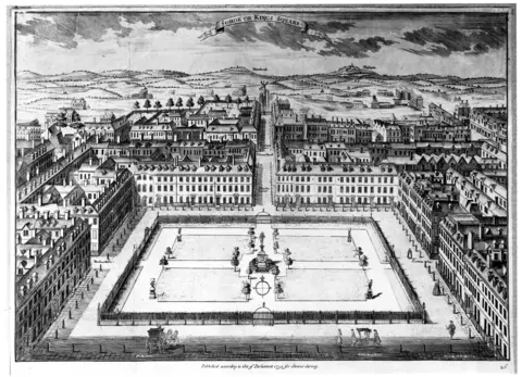 London in the 18th Century/Atlantic Publishing
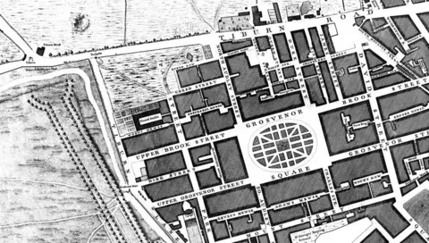
Many areas depicted on the map were fields and at the time lay outside the City of London - but there are buildings on the map that still exist today, including the church of St George in Bloomsbury, which was built between 1716 and 1731.
Brindle said: "It would have been a great monument, it would have loomed above all the other houses in the street.
"London changed and rebuilt so much - now the other buildings all loom over the church.
"It's slightly overwhelming, actually; I mean it was the whole of London in 1746 and it's such a beautiful thing, too. It's so beautifully drawn and engraved."
 London in the 18th Century/Atlantic Publishing
Listen to the best of BBC Radio London on Sounds and follow BBC London on Facebook, X and Instagram. Send your story ideas to hello.bbclondon@bbc.co.uk