Weather warnings issued for heavy rain and strong winds in parts of UK

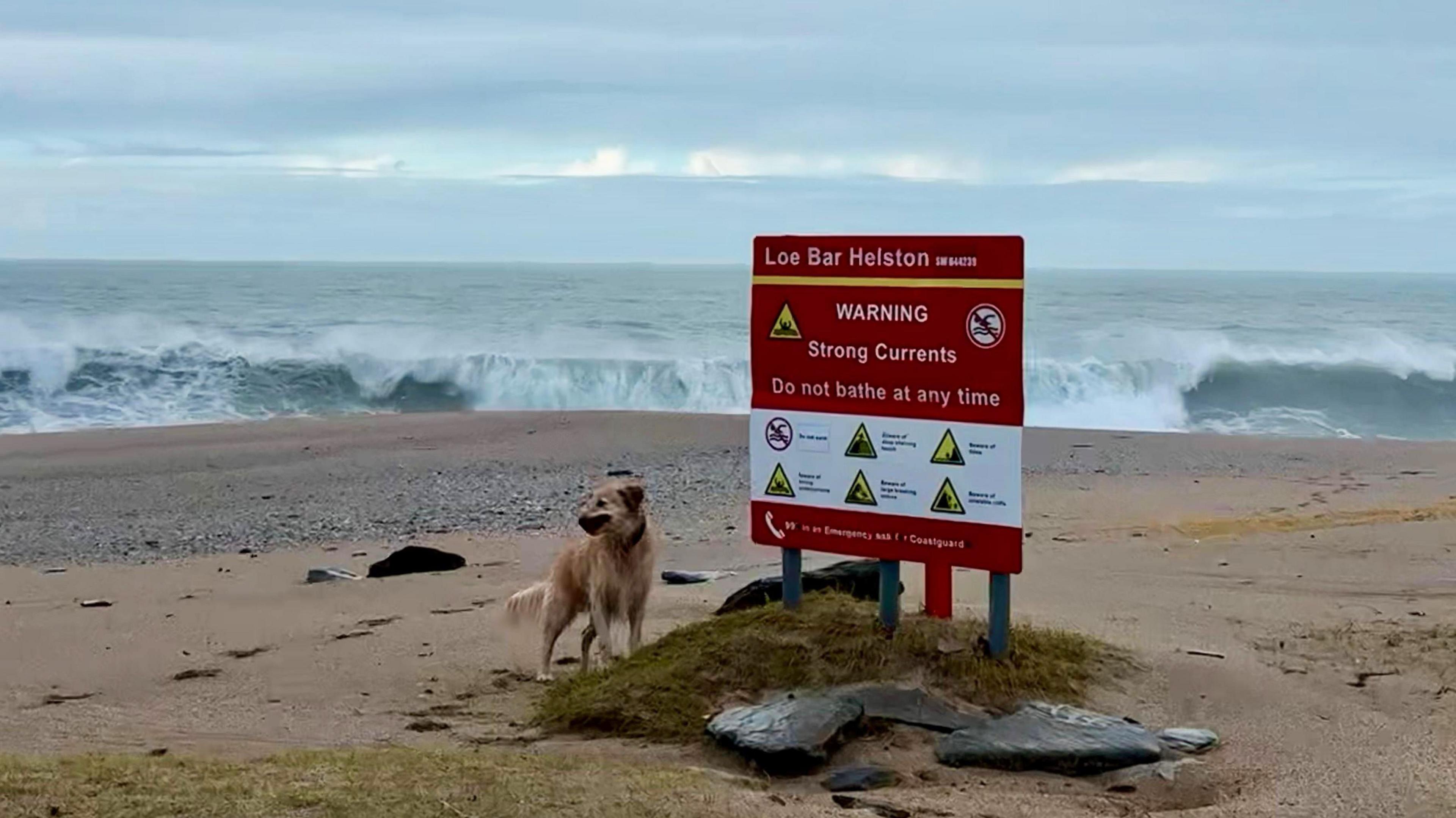
Strong winds and large waves will develop around coastal parts of South West England
- Published
Met Office weather warnings have been issued for wind and rain in parts of the UK.
The very wet weather will continue across eastern Scotland but Storm Ingrid - named by the Portuguese weather service - brings more rain across England and Wales.
Strong winds will accompany the rain, especially in south-west England with coastal gales.
Some travel disruption is likely due to flooding but large waves combined with high tides will bring coastal overtopping and additional hazards.
Heavy rain and wind warning as schools closed and roads flooded
- Published22 January
How to stay safe during a storm and what to do in a power cut
- Published1 day ago
Heavy rain will continue across eastern Scotland on Friday with a Met Office yellow warning in force here until 23:59 GMT on Friday with another yellow warning issued running from midnight on Saturday until 09:00 GMT on Sunday morning.
Rain here has been persistent since Wednesday with parts of the Highlands recording in excess of 130mm up to Friday morning.
The Met Office are warning that surface water and river flooding is expected across eastern Scotland.
There are more than 30 flood warnings in force from the Scottish Environment Protection Agency.
After heavy rain elsewhere this week, the Environment Agency has over 180 flood warnings across England and Natural Resources Wales has 5 flood warnings across Wales.

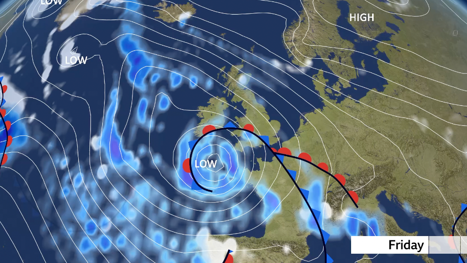
Storm Ingrid sits to the south-west of the UK bringing coastal gales and large waves
Meanwhile, Storm Ingrid will bring further heavy rain and strong winds to south-western areas of the UK.
A yellow warning for wind and rain covers south Wales and south-west England until 09:00 GMT on Saturday.
Gusts up to 60mph are expected in south-west England and Wales through Friday.
But, locally on exposed areas they could touch 70mph at times leading to large waves and risk of coastal overtopping and flooding.
While the winds won't be as powerful or dangerous as the near 100mph winds experienced in south-west England during Storm Goretti, there could still be some impacts.
It will likely stay windy through Saturday morning as the centre of Ingrid stalls to the south-west. Winds will gradually ease as the day progresses.
The rest of the UK will avoid any impacts associated with Storm Ingrid, but the rain in eastern Scotland will continue, with some snow over higher ground.

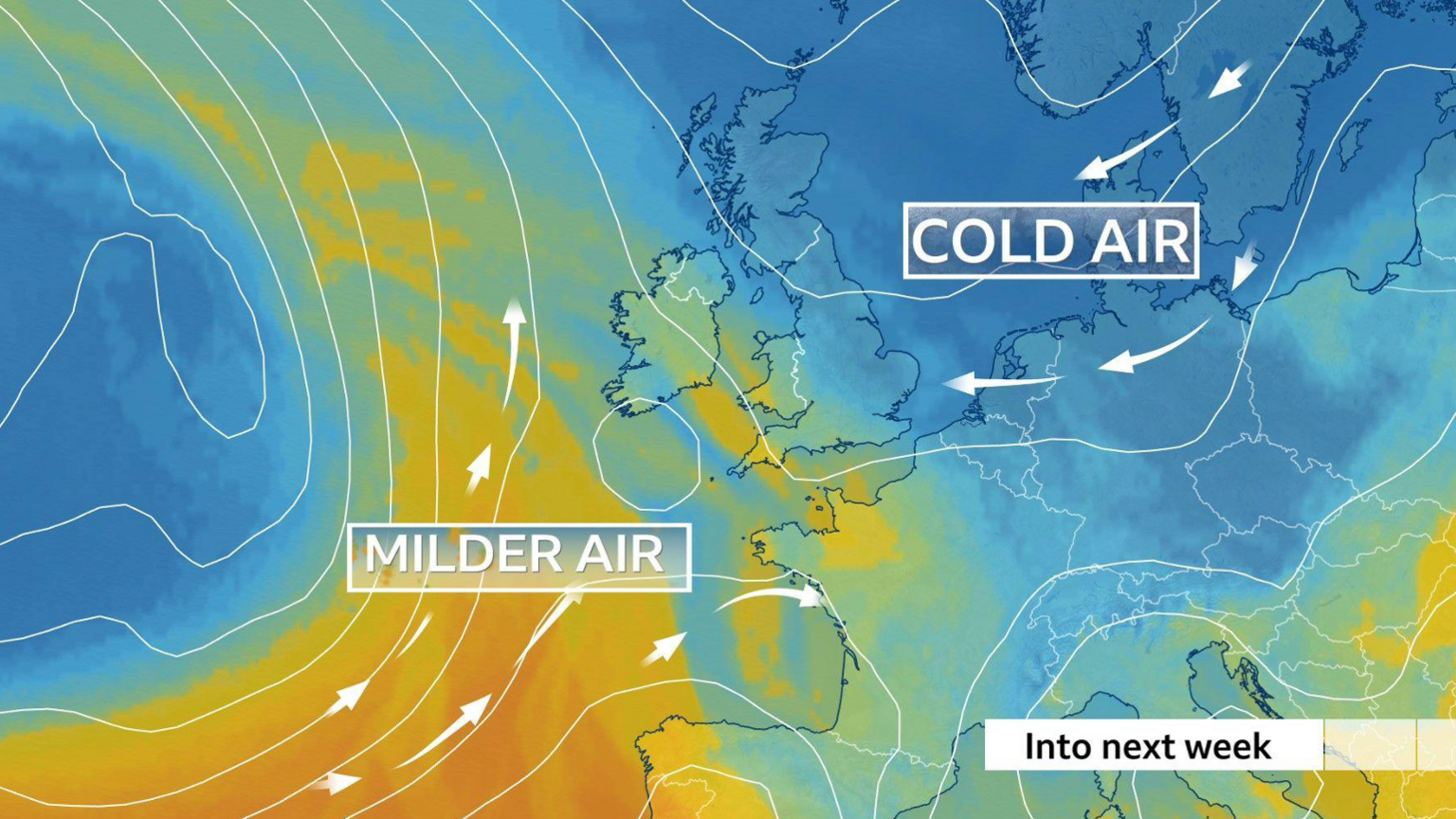
Colder air from northern Europe will start to spread across the UK from the weekend and into next week
Cold snap coming
While Storm Ingrid will affect south-western parts of England, for the rest of the UK, we will start to see a brisk south-east to easterly wind.
Drawing in colder air from north-east Europe, temperatures will start to drop over the weekend and next week with a cold snap.
By Monday, temperatures will fall to 4 to 6C below the average for the end of January.
The easterly wind will also likely bring occasional wintry showers, with snow for some parts of the UK.
By Tuesday a weather system will approach from the west bringing milder air and rain. But, as this rain hits the colder air, it will turn to snow for some.
The highest risk of snow on Tuesday will be over hills of Wales, northern England and parts of Scotland.
Rain is expected at lower levels.
Flying in a Storm
Ever wondered how pilots keep so cool when landing a plane in a storm? We look at how the aviation industry handles extreme weather and turbulence, from flight simulators to keeping passengers calm.
Storm names 2025-26: How do storms like Ingrid get their names?
- Published26 January
Weather for the week ahead
- Published4 hours ago
Get in touch
Do you live in an affected area? Get in touch.