Extreme cold and disruptive snow to hit eastern USA this weekend
BBC forecaster Sarah Keith-Lucas looks at the new storm to affect the US this weekend
- Published
As large parts of the United States continue to dig themselves out from the aftermath of a major winter storm, another system is expected to develop off the south-eastern coast.
Last weekend's storm dumped more than 20 inches of snow in some areas, disrupting thousands of flights, cutting power to hundreds of thousands, and causing multiple deaths.
Whilst this weekend's storm is not expected to be as widespread or as long-lived as the previous system, portions of the Appalachians to the Mid-Atlantic are forecast to see further disruptive wintry weather.
Extremely cold weather will grip much of the eastern states, as far south as southern Florida into early February. This has already led to a delay in launch preparations over the weekend for Artemis II moon mission based at the Kennedy Space Centre near Orlando.
Snow, wind and coastal hazards
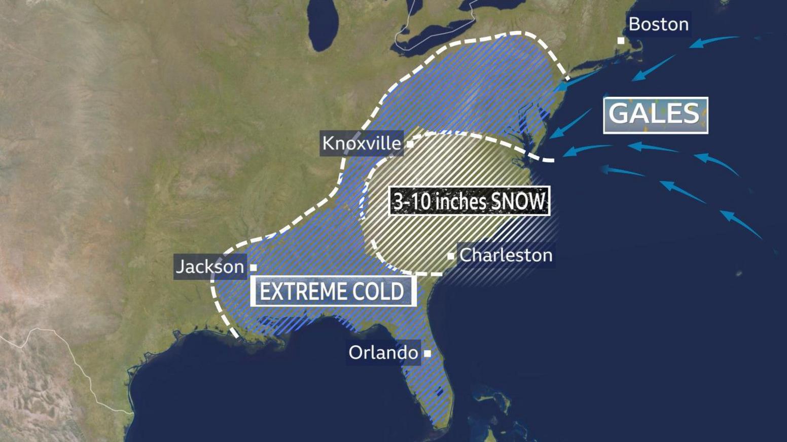
Winter storm warnings have been issued for several states in the east. The Mid-Atlantic region is expected to be worst hit, with exceptional cold spreading as far south as Florida
On Saturday, the low pressure system will strengthen rapidly as it moves out into the Atlantic, with heavy snow and gales developing around the Mid-Atlantic states. It is expected to become a 'nor'easter'. This is the term given to a deep area of low pressure that brings strong north-easterly winds to the East Coast from the Atlantic, and can deliver heavy rain, snow and gales.
Winter storm warnings, external have been issued for parts of northern Georgia, South Carolina, eastern Tennessee, North Carolina and southern Virginia. Snowfall in these regions could reach up to 10 inches (25cm). Coastal gales and a storm surge will be additional hazards, as high astronomical tides combine with powerful onshore winds from the North Carolina Outer Banks northwards. Blizzard conditions are likely, leading to potential power outages and difficult travel conditions in the region.
By Sunday, the snow should start to ease away from the east coast, but extreme cold will continue to impact many regions in the south-east. Below freezing temperatures are expected as far south as southern Florida. Temperatures this low there have not been experienced since the record cold month of December 1989.
Will the storm be a bomb cyclone?
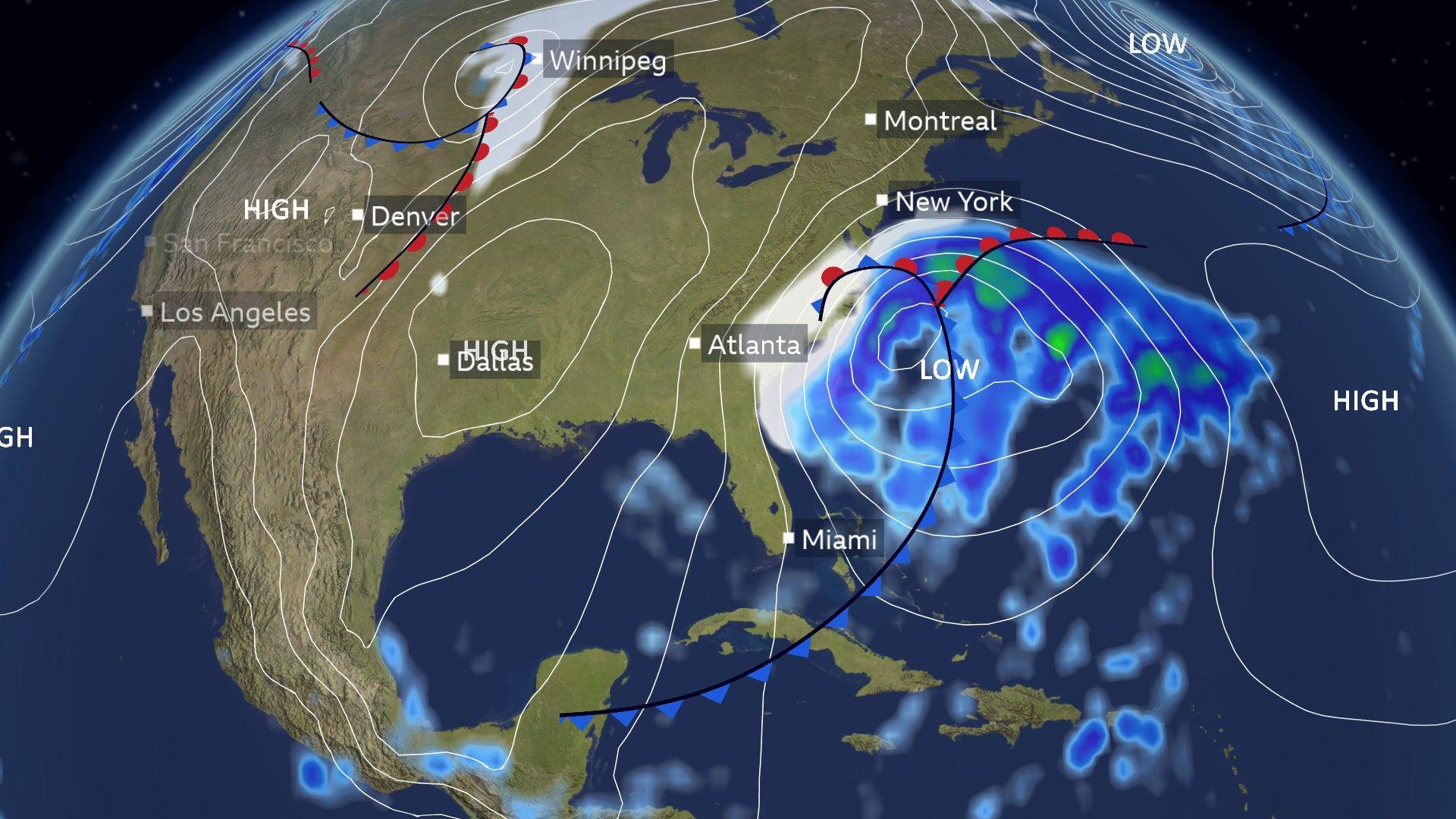
A deep low pressure system is expected to under go rapid intensification close to the south-east coast into the weekend
The storm system is forecast to strengthen rapidly as it moves out into the Atlantic on Saturday.
The term 'bomb cyclone' or weather bomb describes a storm that undergoes explosive cyclogenesis, where its pressure drops very quickly - by 24 millibars or more in 24 hours. Such storms can bring very strong winds, heavy snow, and coastal impacts, making even a short-lived event potentially disruptive. This winter storm is expected to meet the criteria for being defined as a 'bomb cyclone'. It will be fuelled by a sharp temperature contrast being cold Arctic air meeting the relatively warm, moist air in the western Atlantic.
Arctic air keeps its grip
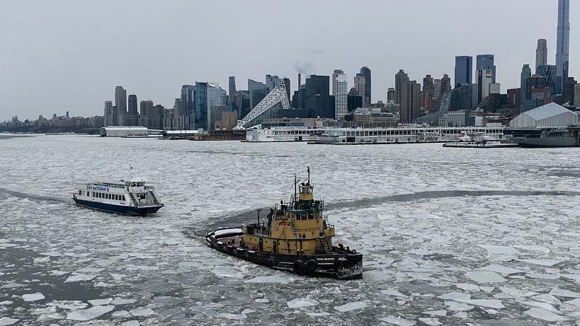
Ice floes on a partially frozen section of the Hudson River as freezing temperatures grip New York, United States on January 27, 2026.
Bitterly cold Arctic air is locked across the eastern half of the country. Temperatures across many eastern states will be as much as 15C (59F) below the January average.
A freeze warning in Florida warns of potentially record-breaking cold weather Saturday night. Hard overnight frosts will extend to coastal areas which very rarely experience freezing conditions.
Snow and ice already on the ground are unlikely to thaw, making the region vulnerable to any additional snowfall.
The US National Weather Service notes this could become the longest-lasting cold spell in several decades.
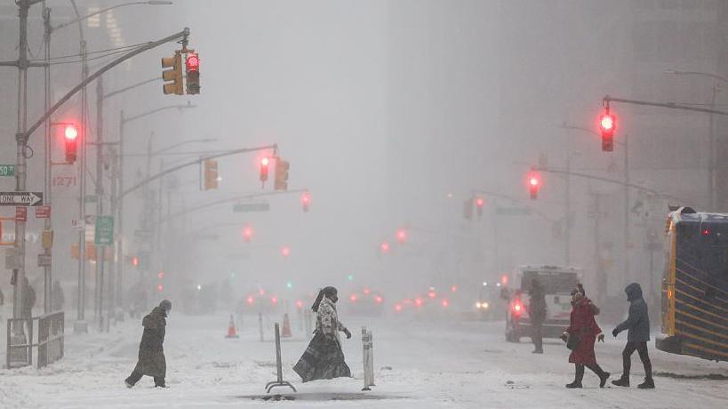
Snow falling on Sixth Avenue in the Manhattan borough of New York City on January 25, 2026.
What's behind the recent Arctic blast?
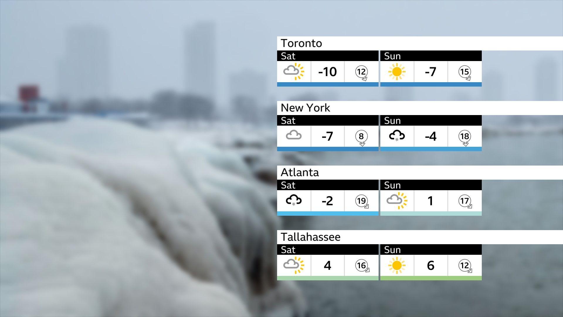
Forecast daytime maximum temperatures
The unusual positioning of the jet stream has created persistent northerly winds, driving Arctic air into regions that rarely see such cold, from the Midwest to Florida.
Overnight lows have hit -27C (-17F) in parts of Ohio, while Florida's Panhandle experienced frosts of -5C (23F). The combination of these winds with snow still on the ground has helped the cold linger and intensify, making conditions feel even harsher.
The current pattern is likely to keep temperatures well below average across the eastern US for the rest of the week.
Check the latest forecast
- Published2 January
