UK to get brief respite from rain, forecasts show

- Published
You would be forgiven for thinking the rain this year has been relentless - because in some parts of the UK, it actually has been.
Here at BBC Weather we have been watching computer models closely for signs of when that pattern will change.
These computer-generated forecasts go out about two weeks into the future - and models have often been hinting at a change to colder and drier weather on that timescale. However, they have then reverted to the familiar wet pattern as we have got closer to the time.
Now though, there are stronger signals of a change for some of us - albeit perhaps only a temporary one. And as relentless rain eases for a time, some places may see a return to snowy conditions.
When will the pattern shift?

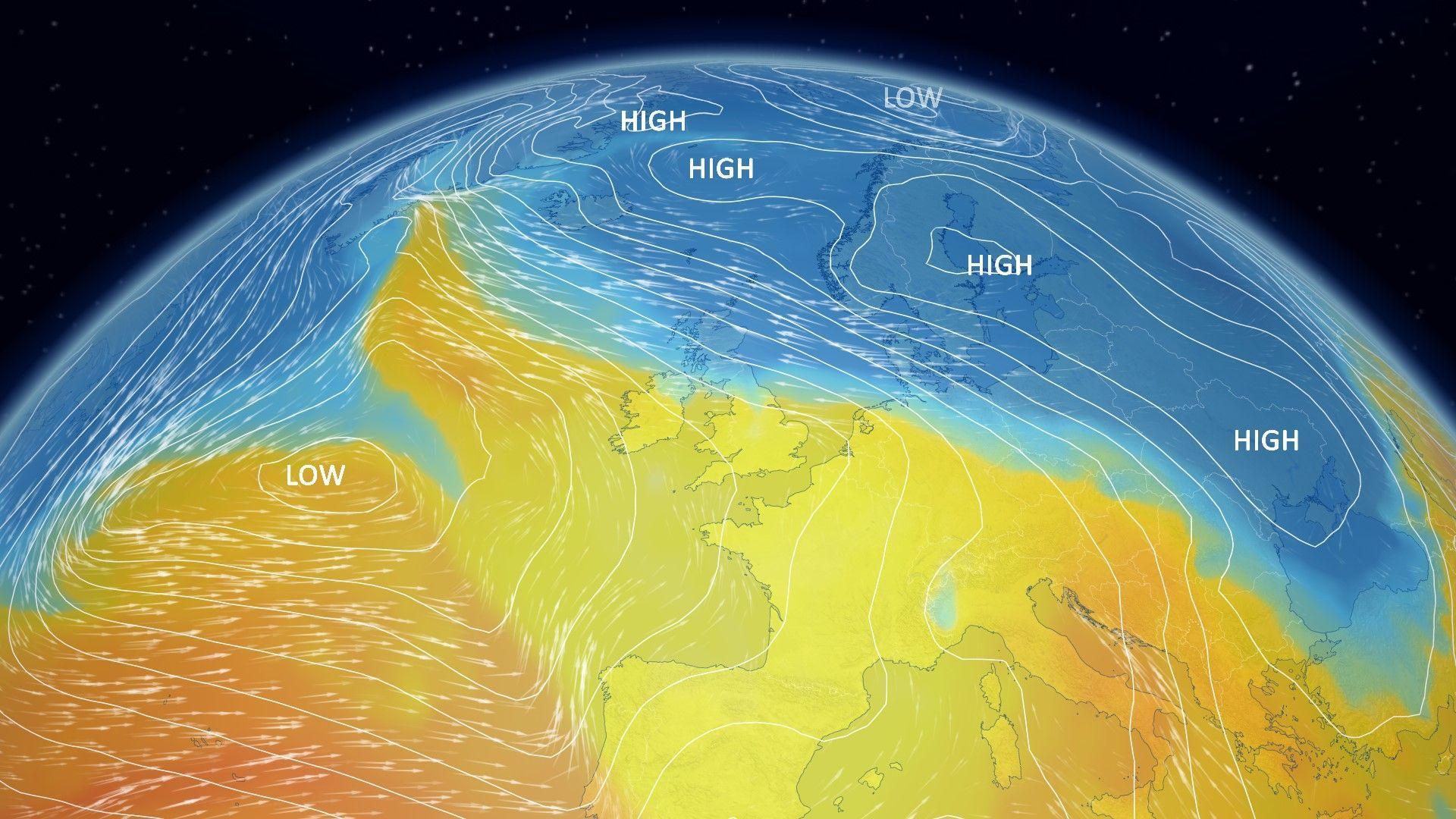
Sunshine and snow are both possible if colder air arrives
For several weeks now, the weather has been stuck in a blocked pattern, external, with high pressure to the east diverting a series of rain-bearing weather fronts across the UK.
For the weather to dry up, this pattern needs to change and a short-lived reprieve may be on the way.
While spells of rain will continue through the next few days, it looks like higher pressure will start to build across the UK later in the week.
This is expected to turn things drier and brighter later on Thursday and into Friday. However, as colder and clearer conditions develop, some snowfall is likely at times too.
The areas most likely to see any snowfall this week are northern and eastern Scotland, the Pennines, the Peak District and the hills of Wales. There is however a chance of some sleet or snow to lower levels for a time as clearing rain meets colder air.
However, it might be worth keeping the wet weather gear handy. Early indications are that milder westerly winds from the Atlantic will return during the third week of the month - delivering more wind and rain.

A blocked weather pattern with south-easterly winds has lingered for most of 2026 so far
Just how wet has it been?
Rain gauges at locations including North Wyke in Devon and Astwood Bank in Worcestershire have recorded precipitation every single day so far in 2026.
There have been a few exceptions - notably parts of western Scotland and north-west England which have been drier than normal.
Statistics from the Met Office revealed that Northern Ireland had its wettest January in 149 years - while it was the wettest January on record for County Down and Cornwall.
February has brought little improvement so far.
Provisional Met Office data shows that some parts of the UK recorded more rainfall in the first five days than they would normally expect over the course of the whole month.

White and blue areas on this map show areas that have already had close to - or more than - their typical rainfall for the whole of February
Aberdeenshire has been one of the wettest places of all. Aboyne has already seen 376mm of rainfall up to 9 February, which is almost half it's expected annual rainfall (800mm) just six weeks into 2026.
It should perhaps come as little surprise that the rain has also been accompanied by a seemingly unbreakable sheet of cloud.
Aberdeen recorded no sunshine for 18 days from 22 January - provisionally the longest sunless spell on record for the city.
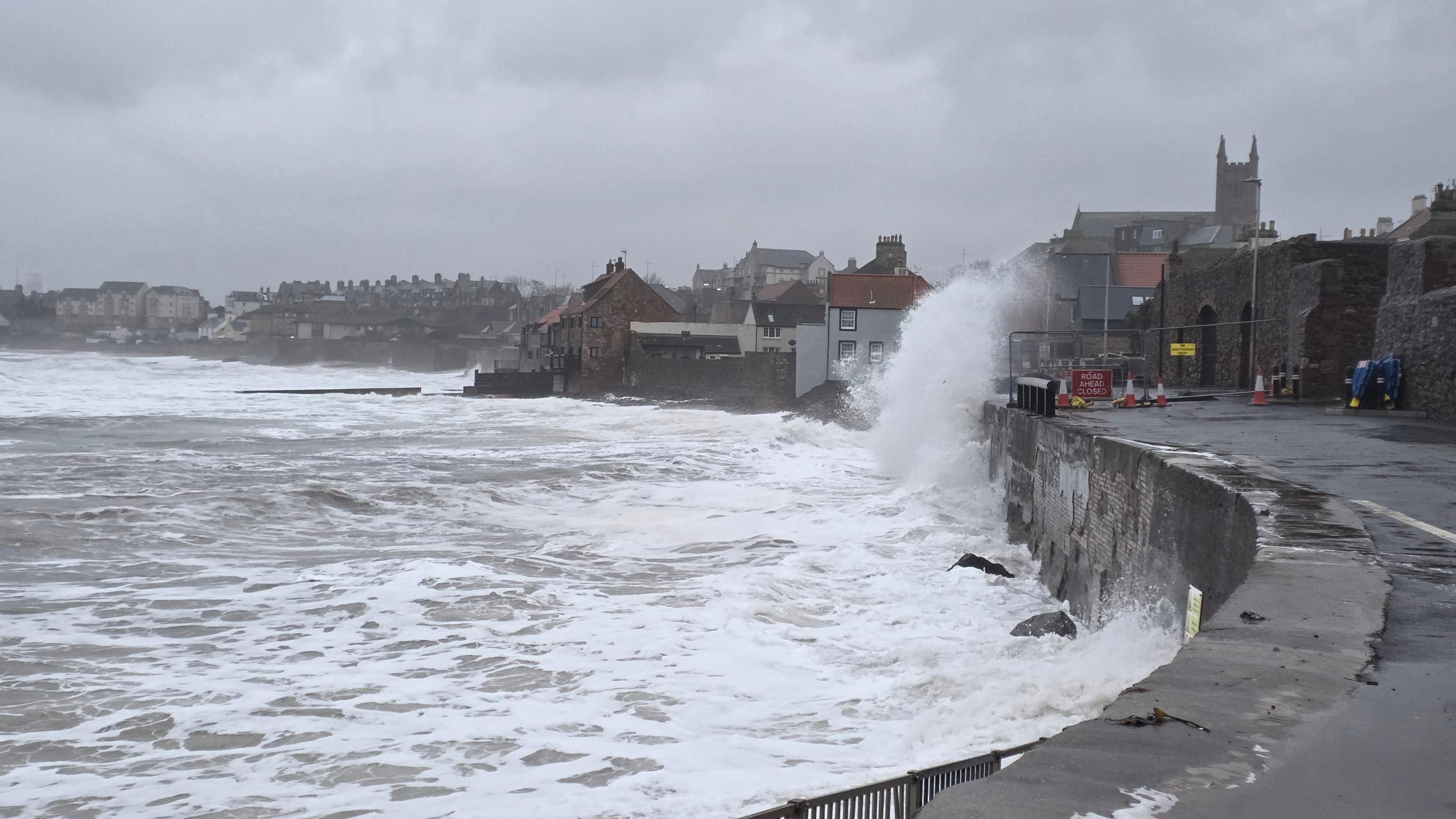
Southern and south-western parts of England have also been badly affected by flooding and travel disruption.
Conversely, some areas of north-west England and western Scotland have been drier than normal, with Aultbea in the north-west Highlands recording no rainfall for 20 consecutive days.
You can get more detail on the long-range forecast in our monthly outlook.
And the hour-by-hour forecast for your area is always available on the BBC Weather website and app.
- Published2 days ago

- Published10 December 2022
- Published7 April 2022